South Marsh Loop (Elkhorn Slough)
An easy hike for families and dogs.
Ecosystems: wetlands, oak woodlands, and grasslands.
Below is the Google Map location where we parked. If you’re using Apple Maps, use the following coordinates: 36.816923, -121.730159
Elkhorn Slough is between Santa Cruz and Monterey, spreading across two counties. The hike we went on starts at the visitor’s center in Watsonville. If you’re going after a storm, it’s a good idea to check the website for closures. In our case, Elkhorn Rd south of the visitor’s center was closed due to storm damage so we had to go the long way, but it was a nice drive.
Learn more on their website about hikes, guided tours, and birding.

There’s a pond behind the visitor’s center where you can start your birding adventure, if you’re into that. There are often swallows zooming around and song sparrows hanging out in the bushes.

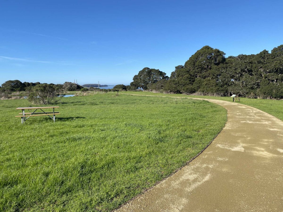
The pathway leading to the slough…
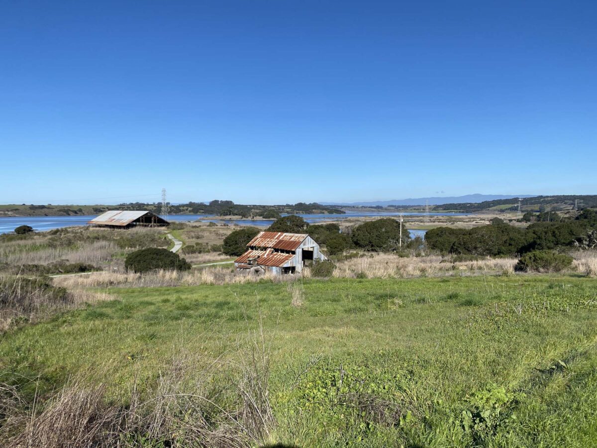
From the top of the hill, you can see Elkhorn Slough and two abandoned barns.
I’m not the greatest at identifying birds, but what I do know is mostly thanks to the Merlin Bird ID app. It’s really fun to use Step-by-Step ID but they also have a Sound ID where you record with your phone mic and it’s identifies bird song.

We’re going to check out the copper-roofed barn first.
It’s really hard to tell with the lighting, but there is a raven’s nest in the rafters. I was surprised at how large it is.

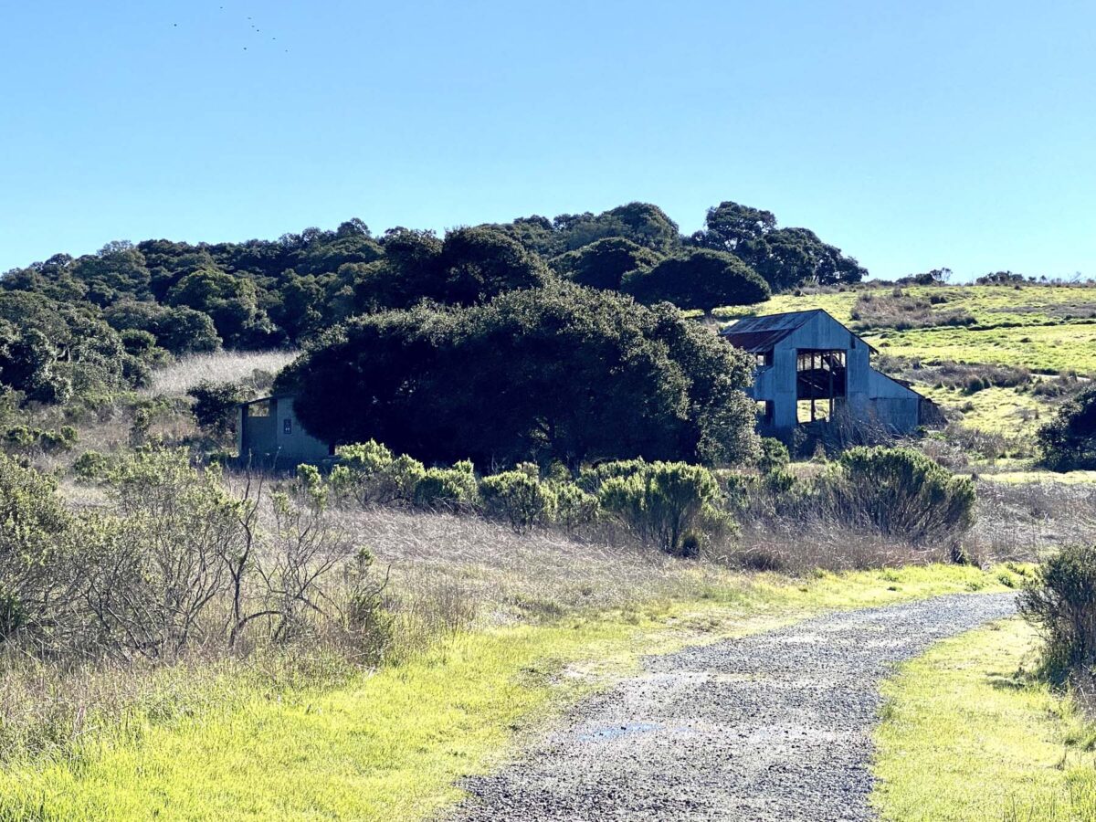
Then we walked up to the other abandoned barn…

There’s an owl box, but I’m not sure what kind of owls live there.

You’re not allowed in the barn, but we did find an owl pellet at the entrance!

There is a wooden boardwalk that is a great place for wildlife viewing.

You can see birds, otters, and bat rays. I even saw a small shark once! If you have binoculars, you’ll definitely want to pull them out at this spot.

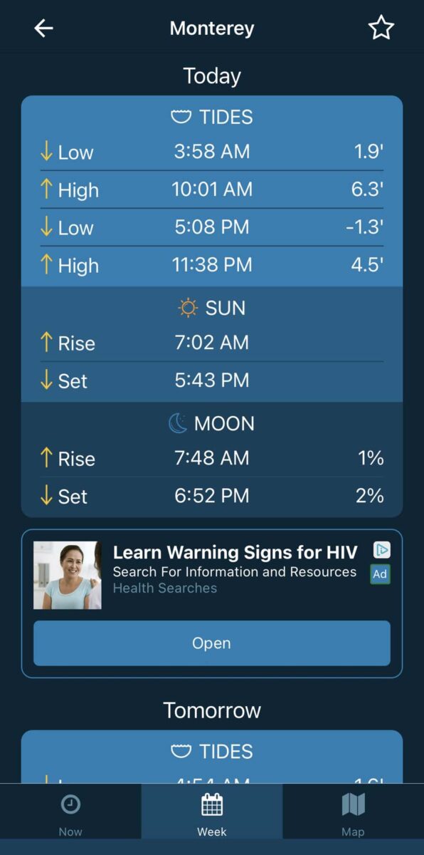
This is from the end of the boardwalk looking out to the right of the South Marsh. The trail we’re on continues over the water but we came just minutes after high tide, so it’s flooded.

You can see better here that part of the bridge is flooded.

In addition to arriving a few minutes after high tide, we also came during a king tide. The high tide for today is 6.3′; compare that to a week from now at 5.4′. I didn’t realize that the bridge floods during high tide, so next time I’ll be sure to check my favorite tide app Tides Near Me (it’s free).
So we headed back to the intersection with the barns. You can see there is a restroom next to the first abandoned barn.
Makes for a more pleasant hike if you have little girls with you!

The trail heading to Cattail Swale, then Rookery Pond.

This Live Oak is a stunner!

The observation deck at Cattail Swale was closed but you can still get a good look.

Turn the volume up to hear an impressive frog serenade.
Heading towards Rookery Pond you’ll start to see a lot of Eucalyptus stumps. This is actually a good thing and part of a decade-long project to remove the invasive non-native trees (from Australia) that were likely planted for timber. They’ve been here for about 100 years and have since encrouched upon the native Coast Live Oak woodlands. The tree removal happens Aug-Nov of each year, until at least 2025.

The trail continues on to Rookery Pond…

Gorgeous algae-crusted pond filled with singing frogs!

Make sure the sound is on!
More felled eucalyptus.

Gravel path out to Hummingbird Island. So glad I didn’t wear my barefoot-soled Merrills!

So green after our recent rains!

I was really looking forward to crossing the train track over to Hummingbird Island but…

Today was not the day. I’ll be back another time… during low tide.

You can still see a patch of Eucalyptus on the left. Most of the Eucalyptus has been removed and some day the ecosystem can return back to Coast Live Oak Woodland.

Back at the visitor’s center. Be sure to check out the inside, there’s some really interesting displays and helpful rangers or volunteers to answer questions.


