S.F.B. Morse Botanical Reserve (Pebble Beach)
I’ve been in this forest many times. I usually stick to the same route. My favorite being one that goes along Haul Road and then I take a super fun trail back to the bottom, which is runnable. The I-feel-like-a-kid-again kind of runnable.
But this is not that trail. I find it really difficult to follow the trails here. I was worried I’d get lost, even having a copy of this hike (#41) from my hiking book. And I did. But here’s my best attempt at helping you not get lost.
This is the entrance. It’s just before Bird Rock Road.

These are the first flowers that greeted me on the trail.

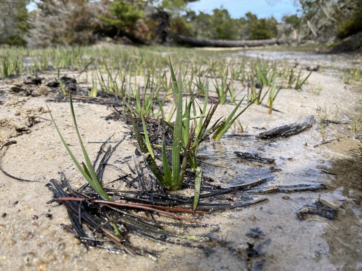
It took me about an hour to walk the first 0.5 mile. So many plants to notice.

Braun’s Giant Horsetail (Equisetum telmateia braunii) Solomon’s Plume (Maianthemum racemosum) Baldhip Rose (Rosa gymnocarpa) budding. Evergreen Huckleberry (Vaccinium ovatum) This is a very young plant, they can grow up to 6′ tall and wide. I thought this was so beautiful with the coloring. There are a lot of these bushes here. So much so that it is referred to as Huckleberry Hill–not to be confused with the Huckleberry Hill Nature Preserve in Monterey. I find it confusing.


Not surprisingly, after 14 atmospheric rivers hit our area this winter (out of 31), there are a lot of downed trees. But it does look like there has been some clean-up, so it’s passable. Just be prepared to climb and duck.

Another tree joins the deathly end of the cycle of life. Soon it will be a home for decomposer insects and fungi.

This spot was my first point of confusion. The next directions are to curve left. There is a trail here on the left with some redwoods. Don’t be fooled. Keep along the trail, which curves right, then left.

You’ll soon run into a small drainage creek. If you stand still here for a minute and look to your right…

You’ll notice a rocky wall. All of S.F.B. Morse Botanical Preserve is made up of marine terraces, which are step-like cutouts in the land. Each “step” was created by a combination of wave cutouts and tectonic uplift. The area here has very shallow layers of sand and soil on top of rock, which provides a very nutrient-poor environment for plants. That’s why this forest is so interesting. The plants you see here are fighters and adapters. There is a pine pygmy forest here, where the trees are stunted due to the extreme nutrient-poor soil. I’m not sure where it is though.
Continue along the trail and you’ll see this bridge. There’s also a nice bench to sit on.

As I walked on, I found a spot to the left with some dead wood. There were so many lichens, fungi, and moss on them!
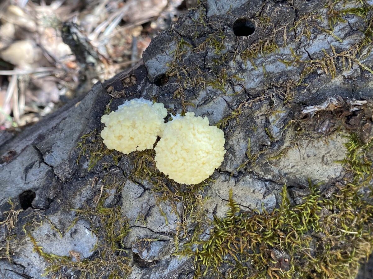
False Puffball (Reticularia lycoperdon)
A slime mold! My first one! It looks like a tiny cauliflower.Stereum ochraceoflavum
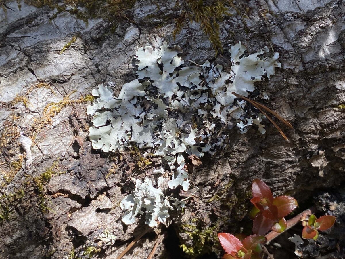
The Seek app and iNaturalist had a hard time with this one. Also, what are those beige pellet things in the background?! Nature is a fascinating mystery.Ruffle Lichen (Parmotrema)
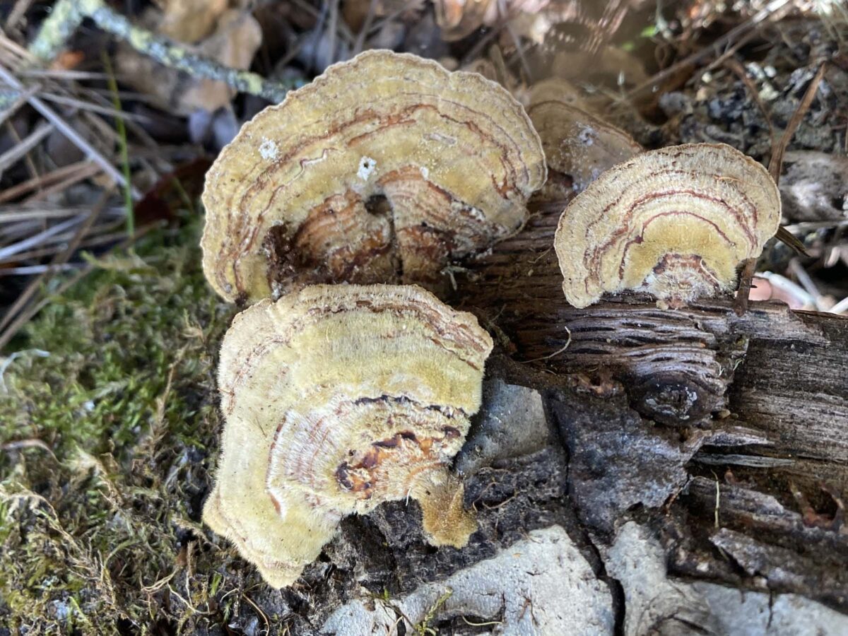
Genus is all I got, no species info. I think these are beautiful. Sometimes they are blue-gray.Ochre Bracket (Trametes ochracea)
Like Turkey Tails, but not as pretty.Cramp Ball (Annulohypoxylon thouarsianum)
A decomposer fungus nestled in moss.Bristly Beard Lichen (Usnea hirta)
Lichens and fungi have the best names.


There was also some Trailing Blackberry along the creek. I’ve never noticed this plant before and will be sure to look for it again on future hikes with my kids. They already like to come here to pick huckleberries.


Some helpful stairs to climb a steep portion of the trail.

More things to stop and see…
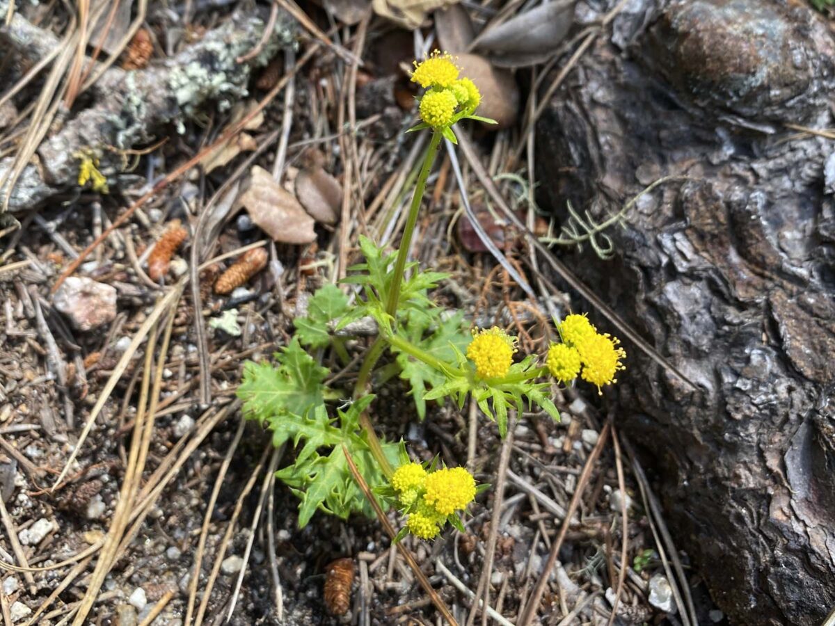
Laceleaf Sanicle (Sanicula laciniata) Western Fence Lizard (Sceloporus occidentalis) Alpine False Springparsley (Psudocymopterus montanus)


You’ll pass a post with “5,” “6,” and then “7.” Immediately after this, you’ll reach the fire road mentioned in the book.

Here’s the fire road. Turn left.

Soon after, you come along this split in the trail. Go left again.

Another split, this time with signposts. Left for Trail 2, right for Trail 5. Go to the right. I’ll confess I got confused here and went left. But I did end up seeing a lot of Warrior’s Plume, Ceanothus, Balsam Bird’s Foot Trefoil and a variety of lichen, so it was worth it.

Here are some of the plants I saw:
Warrior’s Plume (Pedicularis densiflora) This is a hemiparasitic plant, meaning it will attach to another plant’s root system for nutrients but it can also create it’s own chlorophyll. So sometimes its leaves are red (parasitizing) or green (creating its own chlorophyll). California Lilac (Ceanothus) I’m not sure which variety this is, there are so many. They come in different forms: ground cover to 15′ bushes, some people even trim them to look like trees. You can find them at local nurseries. Bees love them and they’re very hardy. I highly recommend them for your garden. Gowen Cypress (Cupressus goveniana) Many people are familiar with the iconic Monterey Cypress, but they naturally grow near the coast. The Gowen Cypress grows farther away from the shore and at higher elevations. One way to tell the difference is to smell their leaves. The Gowen Cypress smells strongly of citrus, the Monterey Cypress doesn’t. Here we have yellow Brown-Eyed Sunshine Lichen (Vulpicida canadensis), reddish-brown Red Beard Lichen (Usnea rubicunda), and some kind of white/black tube lichen. They were all growing on a dying Gowen Cypress. Balsam Bird’s Foot Trefoil (Hosackia stipularis) This delicate flowering bush with the impressively long name was one of my favorite finds. Wish I could find this at a local nursery. I noticed that the leaves reminded me of pea leaves and it is indeed a member of the Fabaceae (legumes) family.


This is where I really got confused and I think I ended up going the wrong way. This is the 4-way junction mentioned in the book. We’re directed to continue 20 yards to signpost 13. But I didn’t see a signpost 13. So I kept going…

…and got distracted taking photos of plants and also! It was so quiet, just me and the forest. I heard something nibbling. It took me a while but I finally laid eyes on a Western Gray Squirrel! I’ve never seen a gray squirrel in Monterey, only the Fox squirrels in my yard and the ground squirrels near the coast. It was a lot bigger than the Fox squirrels and much more shy.

Here are some photos I took on my detour…
Cramp Balls (Daldinia concentrica) Fungus that lives on dead wood. I love how they polkadot the wood. This is a great example of how life prevails in nature. Death is the start of life for some. Giant Chain Fern (Woodwardia fimbriata) These are impressively large ferns that grow up to 8′ tall and wide. They like water, so you’ll usually only see them near a water source. Giant Chain Fern sori The characteristic sori (capsules that hold spores), oval-shaped and lined up neatly in double rows give the fern its name. Irisleaf Rush (Juncus xiphioodes) These were growing all over in puddles along the trail. It still amazes me how many plants in California adapt to the long cycles of drought.


After walking for about 1/4 mile, much farther than the instructed 20 yards, I turned around and headed back to the 4-way junction. This time I purposely walked about 20 yards and all I could find was this trail off to the left, that looked obviously NOT maintained. I still couldn’t find the elusive signpost 13. The next time I go, I might try taking the left at the junction (right before the fallen tree).

After a short while, I came across this. I was able to squeeze through on the left. I’m not sure what I’d recommend at this point, since as you’ll see later, I think this was the wrong trail. But it still meets up with the intended path…. I think.

After a little farther, I met up with what I think is Trail 3. You’ll notice a nice trail off to the right. I’d like to go back here and see where that connects to Trail 5.

After taking a right on Trail 3, I came to the 3-way trail split mentioned in the book. The fun adventurous thing about this area is that as long as you have a compass (or good sense of direction) you can find your way out. It’s confusing and meandering but not nearly as disorienting than the winding paved roads of Pebble Beach.

Again, I couldn’t follow the instructions in the book, they didn’t make sense to me. But I’ve been to this area many times, so knew my way to the final destination. When you get to the Trail 3/Trail 29 junction, take a left along Trail 29.

You’ll follow a fire road to Congress Road. Walk back to your car along the street. Walk with caution if you have little ones with you! The road is windy and there are some blind turns.

My appreciation for this forest comes from being able to notice the amazing diversity of life (and death). Some people may look at this forest and think it’s a dying, but there is actually so much life, if you’re just willing to take the time to see.
I hope you enjoyed this post! Please let me know if you have done this hike and what you think.


